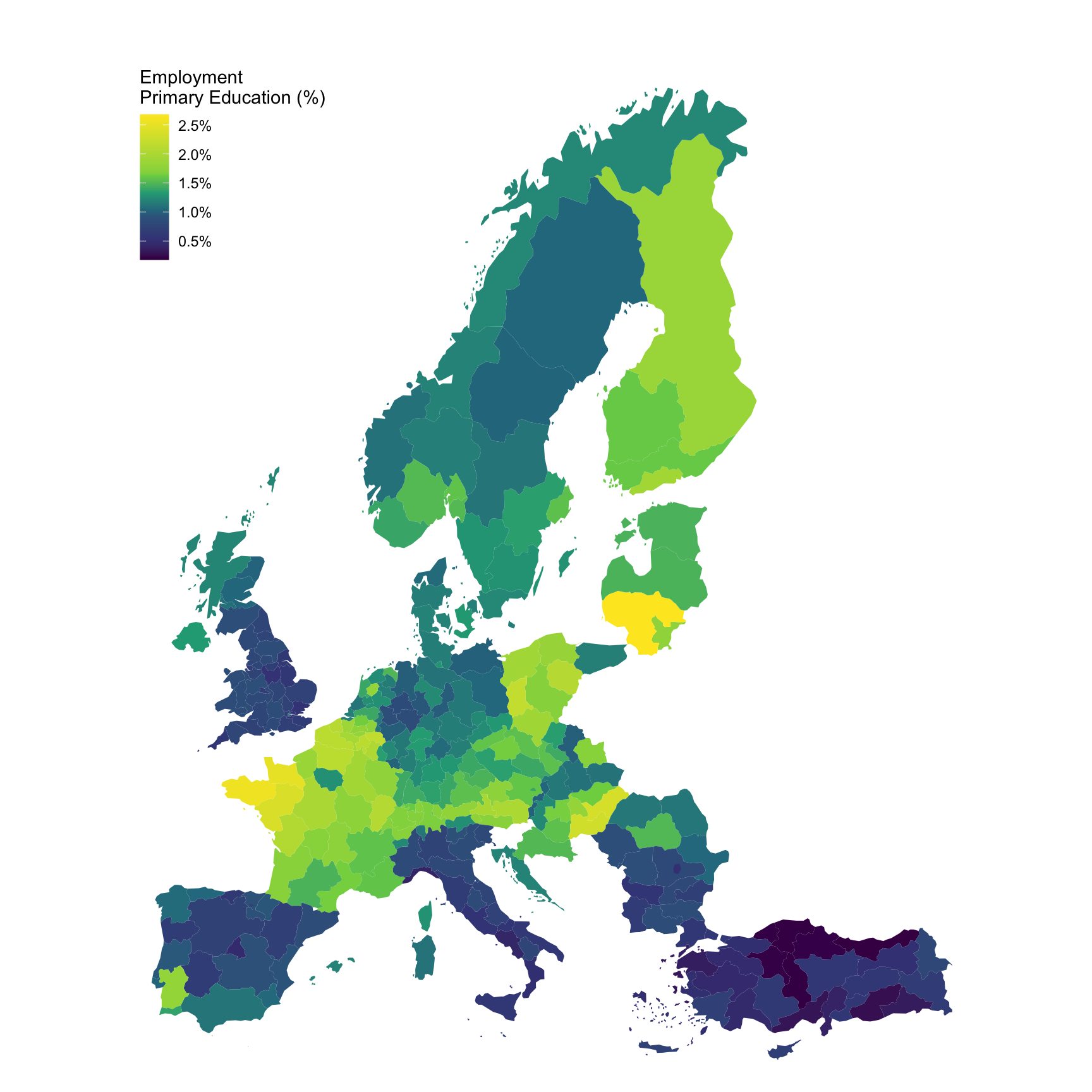
Last observation: 2023 (N = 3650596)
First observation: 2013 (N = 3658388)
Last data update: 02 août 2026, 08:00
Last compile: 09 oct. 2026, 22:22
hlth_cd_ycdr2 |>
  filter(time == "2015",
         age == "TOTAL",
         sex == "T",
         geo == "FR") |>
  left_join(icd10, by = "icd10") |>
  select(icd10, Icd10, values) %>%
{if (is_html_output()) datatable(., filter = 'top', rownames = F) else .}hlth_cd_ycdr2 |>
filter(time == "2015",
age == "TOTAL",
sex == "T",
icd10 %in% c("X60-X84_Y870", "A-R_V-Y")) |>
left_join(geo, by = "geo") |>
select(geo, Geo, icd10, values) |>
spread(icd10, values) |>
mutate(`%` = round(100*`X60-X84_Y870`/`A-R_V-Y`, 2)) |>
arrange(-`%`) %>%
{if (is_html_output()) datatable(., filter = 'top', rownames = F) else .}hlth_cd_ycdr2 |>
filter(time == "2015",
age == "TOTAL",
sex == "T",
icd10 %in% c("X60-X84_Y870", "A-R_V-Y")) |>
left_join(geo, by = "geo") |>
select(geo, Geo, icd10, values) |>
spread(icd10, values) |>
right_join(europe_NUTS2, by = "geo") |>
filter(long >= -13.5, lat >= 33) |>
ggplot(aes(x = long, y = lat, group = group, fill = `X60-X84_Y870`/`A-R_V-Y`)) +
geom_polygon() + coord_map() +
scale_fill_viridis_c(na.value = "white",
labels = scales::percent_format(accuracy = .1),
breaks = 0.01*seq(0, 100, 0.5),
values = c(0, 0.1, 0.3, 0.4, 0.5, 0.6, 1)) +
theme_void() + theme(legend.position = c(0.15, 0.85)) +
labs(fill = "Employment \nPrimary Education (%)")
hlth_cd_ycdr2 |>
  filter(time == "2013",
         age == "TOTAL",
         sex == "T",
         icd10 %in% c("X60-X84_Y870", "A-R_V-Y")) |>
  left_join(geo, by = "geo") |>
  select(geo, Geo, icd10, values) |>
  spread(icd10, values) |>
  right_join(europe_NUTS2, by = "geo") |>
  filter(long >= -13.5, lat >= 33) |>
  ggplot(aes(x = long, y = lat, group = group, fill = `X60-X84_Y870`/`A-R_V-Y`)) +
  geom_polygon() + coord_map() +
  scale_fill_viridis_c(na.value = "white",
                       labels = scales::percent_format(accuracy = .1),
                       breaks = 0.01*seq(0, 100, 0.5),
                       values = c(0, 0.1, 0.3, 0.4, 0.5, 0.6, 1)) +
  theme_void() + theme(legend.position = c(0.15, 0.85)) +
  labs(fill = "Employment \nPrimary Education (%)")